November to April. The passes hold snow and the huts are shut, so the route is a mountaineering problem rather than a walk.
Mid-June to late September. Mid-July to early September is the core of it: the high passes are clear of snow and effectively every hut and village on the route is open. September brings fewer people and cooler walking, but shorter days and more frequent storms, and the huts begin closing from late September. The official season runs to mid-October, and late May or early November is walkable in a low-snow year if you check conditions first.
At 22, I set out to become the first Israeli to cross the Alps on foot via the Via Alpina Red Trail - 2,299km with 113,786m of cumulative elevation gain, carrying a 22kg pack. The route crossed 8 countries over 69 days: Switzerland, France, Germany, Austria, Italy, Liechtenstein, and Slovenia.
I documented almost every single day live, as it happened - not a recap after the fact. Some days were routine; others weren't. One day I broke my own distance record, walking 41km in a single stretch, refilling at the roadside self-serve fridges that dot the Austrian and German trail towns. By day 60, deep in Austria's Carinthia region, the body was worn down but the pace held. The final day brought a strange mix of physical exhaustion, mental relief, and genuine pride.
Total cost for the whole 69 days - food, lodging, transport, insurance, and extra gear - came to about ₪24,000. Base pack weight was 22kg before food and water: a Shimoda 70L pack, two trekking poles, a full clothing and sleep system rated to -5°C, a cooking kit, and a full electronics setup (camera, two lenses, a MacBook Pro, a GoPro, and a DJI Mini 4 Pro drone) to document all of it.
The Map
How to read this map
The orange line — every step walked, as the GPS recorded it
Each dot on it — one day. Tap one to see what happened that day
A filled dot — there's a clip from that day
3DThe 3D button — real satellite terrain, with the villages and huts named
We were up at three in the morning. A flight, a landing in Nice, a supermarket run, and a train straight to Monaco. The walk started at the royal palace.
There were three of us. Before we even flew we had agreed on one thing — that if anyone decided halfway through that he wanted to leave, that was completely fine. Everyone comes to a trip like this for something different.
From Monaco we started climbing stairs inside the city itself, and after a while we found the trail markings. From there it was a day of nothing but climbing. We stopped to eat a few times — apples and pastries we had bought that morning — and every time we turned around, the harbour in Monaco had got smaller below us.
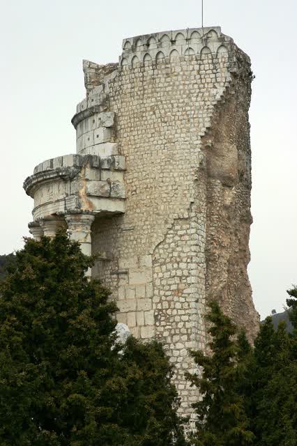
The route passes through La Turbie, and standing there is the Trophée des Alpes: a Roman monument from 6 BC, raised to mark Augustus's victory over the 44 tribes that controlled the mountain passes and blocked the traders. It was originally 49 metres tall. So we started crossing the Alps beside the monument that celebrates their conquest.
We also walked a whole section along railway tracks, went through a village of narrow stone alleys, and through a lot of thorns. At the end of the day we cooked ourselves a meal.
Day one, a hard one. Done.
Trophée des AlpesJosé Luiz · CC BY-SA 3.0 · Wikimedia Commons
Day 02July 19
The landscape kept changing
Through
· · · · · ·
Finished at
Twenty-five kilometres of climbs and descents that never end.
Breakfast of egg and crackers with peanut butter, then a lot of walking on trails. The landscape kept changing — forest, then rock, then thorns.
We filled up on water in the nearest town and stopped for a proper lunch, sitting down, off a plate. We petted cats. We dunked our heads in clear water.
Then it started raining. We pulled out ponchos and kept walking like that, the three of us, on a muddy trail through the forest.
The town we stopped in had a beautiful church. And at the end of the day, of course, a beer — Bière du Col, a local white beer from the Mercantour.
Day 03July 20
Two thousand metres of climb
Started at
Through
· · ·
Two thousand metres of climbing ahead of us.
After breakfast we washed the dishes at the village fountain, filled the bottles and stopped at a market stall to stock up. The climb started steep, and from the very beginning you can see all the mountains we are going to cross.
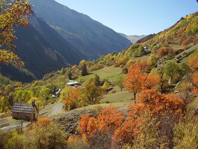
We stopped to eat bananas, sausage and baguette, and entered the Parc national du Mercantour — the nature reserve we would be in for the next few days. At the top we were out of breath and tired, we stopped for a short break, and two dogs tried to take all our food.
Later we saw cows in the fog, Azri picked us wild strawberries, and we reached a local farm that spoiled us with Coke. Alon invented an isotonic trick there — Coke with a bit of salt, straight into the can.
In the evening, a picnic table, a gas stove, a pot and butter. Twenty-six kilometres. Done.
Mercantour national parkRaphink · CC BY-SA 3.0 · Wikimedia Commons
Day 04July 21
The first lake
Through
· · · ·
Today we had been waiting to reach the lakes.
Breakfast of sausage and eggs and some bread with chocolate. On the way we stopped on rocks and passed a whole sausage between us, each of us cutting off a piece in turn. The climbs were really hard.
And then we saw the first lake. The clearest water I have ever seen — we walked in up to our waists.
We descended to the overnight area and reached the hut. Mountain huts here are called refuges. A refuge is a staffed cabin high up, usually somewhere with no road to it at all, and whoever runs it lives there for the whole season. You sleep in a shared room on mattresses in a row, together with everyone else who turned up that evening, and most of them sell dinner and breakfast too. They have an area with gear, even sandals if you do not have any, and a kitchen where you can buy food. It came to 55 euros for three meals.
We did laundry for the first time and hung everything on rails inside. We played cards, ate a lot, drank a lot of beer and tried every kind of alcohol they offered us. Someone pulled out a guitar. In the end we went to sleep in the tent.
Day 05July 22
Joining two stages
Through
· · ·
A generous breakfast at the refuge.
Today we decided to join two stages together to save time later on, and maybe even earn ourselves a rest day.
We crossed two passes at 2,500 metres. A lot of it was boulder fields — jumping from rock to rock with the pack on. On the way there was another patch of snow that we stuck our poles into, and we saw a bit of wildlife. The descents were really steep.
We stopped for lunch on the terrace of a refuge — pasta with meat, facing a lake and mountains. We also tried the local cola there, Cola du Comté, which I do not recommend.
After that came an insane climb. It is hard to show in photos how steep it is.
At the end we dropped down to the overnight area, cooked rice and put up the tents.
Day 06July 23
Down for food, back up again
Started at
Through
Today we had to go down to buy food before heading back into the mountains for a few days.
From La Madone de Fenestre we started down towards Saint-Martin-Vésubie. Long descents, changing views, and cows on the slope beside stone houses.
In town we went into a bakery for the first time and ate French pastries. Really good. We shopped, 130 euros for five days.
And then we started climbing back up. This day was supposed to be a short one. We tried to hitch on the road and failed, and it ended up being 27 kilometres.
In the evening we ate at a full refuge, long tables and every seat taken.
Day 07July 24
Into Italy, past the bunkers
Started at
Through
Col de Fenestre · · · ·
We set out on day seven. Crazy to think we started a week ago — it feels like we have already been walking a month and a half.
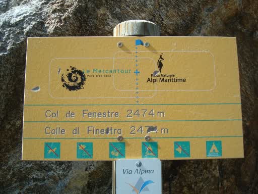
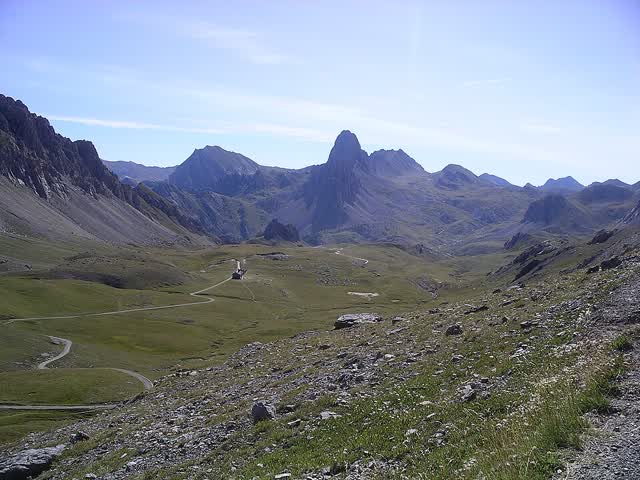
We started with an insane climb up to the Col de Fenestre, and there we added another country. We crossed the border from France into Italy.
The pass is full of Second World War bunkers. They are part of the Vallo Alpino, the line of fortifications Mussolini built along Italy's entire northern border; at the pass itself there are two bunkers and a stone barracks that could hold fifty men.
And through that exact same pass, in September 1943, days after Italy surrendered, around 1,200 Jews crossed from Saint-Martin-Vésubie — the town we left yesterday — together with the retreating Italian soldiers. We walked exactly their route, only in the opposite direction and with a lot less on our shoulders.
We came down and stopped to eat at a refuge. The Italian food is much better — we ate polenta, incredible. After a break of about an hour we carried on to the next climb, another brutal one. There was snow on the way and we slipped on it a bit.
It was the first night we slept indoors instead of in the tent, and another 21 kilometres on the road.
Col de FenestreNerijp · CC BY-SA 3.0 · Wikimedia Commons
Day 08July 25
The dam that is a battery
Through
·
We set out after a night in a bed, finally. We drank coffee and went to the toilet — in the huts here that is a hole in the floor and nothing more.
Then we crossed the dam. A huge concrete wall inside the valley with a green railing along it, and below it a lake in a colour that is hard to believe.
This is the upper part of the Entracque power station, the largest of its kind in Italy and one of the most powerful in Europe. Two artificial lakes — one at almost 2,000 metres and the other at 1,000 — and 42 million cubic metres of water moving between them. When there is surplus electricity they pump the water up, and when electricity is needed they drop it 1,048 metres through turbines. A battery the size of a mountain.
From there a 650-metre climb up to a rifugio — that is what mountain huts are called in Italy. Pasta, coffee and cake. Nothing beats Italian food.
After that a long 1,300-metre descent down to a small resort town. A rainy day, so we treated ourselves to another night in a bed: we raised three earthenware beer mugs on the balcony, drank wine, played chess and had dinner.
A short day, 17.5 kilometres. Good night.
Day 09July 26
The king's mountains
Started at
Through
Finished at
We left Terme di Valdieri, a spa town with hot springs, for a long day with two passes.
A large part of the climb runs on wide stone-paved tracks, with retaining walls and broad bends. These are not walking paths — they are military mule roads from the end of the 19th century, rebuilt in 1909 and again in the 1930s. The whole area is called the king's mountains: Victor Emmanuel II took the hunting rights in the valley for himself in 1857, and his hunting lodge still stands there today, serving as a rifugio.
At the top of the first pass we met a guy doing exactly our route in the opposite direction. He finishes in five days. We started nine days ago.
We came down to a rifugio, ate polenta, drank coffee and had cake and beers. We were feeling good, so Alon and I decided to go over one more pass.
At the end we got the drone out and filmed. We slept in an insane spot, with 28 kilometres and 2,100 metres of climbing behind us.
The Cottian Alps
Day 10July 27
Our last evening as three
Started at
Col de la Lombarde
Through
Finished at
We crossed the Col de la Lombarde, which is the border, and reached Isola 2000 — a ski town built from nothing at 2,000 metres. Concrete between mountains, and in mid-July completely dead.
All the supermarkets were closed. Luckily we found a café, and just then the restaurant opened too — so we treated ourselves to a burger, the first since we arrived. Later at the campsite I found a Magnum I had been craving since we landed.
Then Azri and I found a huge rock in the middle of a green field and started climbing it — no gear, in walking shoes, one climbing and the other spotting from below. Alon filmed.
We pitched the tent in a beautiful valley. 16 kilometres. From tomorrow we start trying to walk 30 a day.
Day 11July 28
Alon goes home, and we pick up the pace
Through
· · · ·
Finished at
Alon left in the morning, before we set out.
We had agreed on the terms before we even flew, exactly for a moment like this — everyone comes to experience something different, and if someone decides he has had enough, that is completely fine.
And from that morning we picked up the pace. Three passes today, two thousand metres of climbing and two thousand metres of steep descent.
We did the first pass and came down to a really cool rifugio — the wall inside is covered entirely in colourful notes people have left, hundreds of them. We had a generous lunch there.
We carried on, crossed another pass and reached the second rifugio for coffee and cake. We were feeling good, so we decided to do one more pass. It was tough and steep, and Azri behind me was about to pass out.
We got to the campsite, drank a beer and put up the tent.
Day 12July 29
First shower in a week
Finished at
A rest day. Only nine kilometres, and the goal was to stock up for the coming week.
We reached a village, drank coffee and took a bus to the nearest town. I am still surprised how hard it is to shop in these towns, and it is the thing that complicates this route most — more than the climbs. The villages are small, the shops open at strange hours, and if you arrive on the wrong day you carry on without food. In the end we found a supermarket, bought what we needed and made a sandwich.
We also had a shower to freshen up. We had not showered in about a week.
We did laundry, set up camp, and I edited some of the videos and went through the photos. In the evening, a café, chess and dinner.
Day 13July 30
Footprints 250 million years old
Started at
Through
· · · · · · · · ·
Finished at
We started with an 800-metre climb, really steep, up to the first pass at 2,700.
The route crosses the Gardetta plateau — open ground at more than 2,000 metres, with a large dolomite cliff called Rocca la Meja that you can see from every point. There are ruins of military barracks up there, and the Gardetta rifugio is actually an old military building converted into a hut.
And on the rocks of that plateau, in 2008, they found reptile footprints around 250 million years old. All of this was a muddy sea floor back then, and even the small ripples the water made in the mud are still visible in the stone. Today it is 2,200 metres above sea level.
After that a really, really steep descent. We reached the campsite and ate — and there was pizza. I had been craving pizza for ages, and it was the first one we ate. It was incredible.
32 kilometres. Our longest day so far.
Rocca la Meja and the Gardetta plateauNem80 · CC BY-SA 3.0 · Wikimedia Commons
Day 14July 31
Two weeks, 36 kilometres
Through
Col de Mary · ·
Finished at
Day 14, closing out two weeks and doing 36 kilometres.
We started with a thousand-metre climb to the Col de Mary, at 2,600 — and there we crossed the border back into France. We came down through streams and forests to Maljasset, and at the rifugio there we had lunch: rice with sausages, ravioli and dessert. 40 euros for the two of us.
Then the Col Girardin, 2,700 metres, seriously tough. Azri behind me could not breathe. At the top the view opens out over the whole ridge.
We came down to a campsite, found wine there, ate and finished.
Our longest day so far. We are picking up the pace.
Day 15August 1
The climb with nowhere to stop
Started at
Through
· · · · · · · · · · · · ·
Finished at
We opened the morning at a café next to where we slept, and stocked up on gas canisters, which we had run out of.
We did the first climb, reached the pass, saw cows and started down. We dropped low, to 1,200 metres, and then there was an annoying climb back up to 2,300.
We could not find anywhere to stop for lunch. We just pushed on to the top.
From there we came down fast, and on the way down we found an open hut with nobody inside. We cooked and ate there.
26 kilometres, all of it climbing and descending.
Day 16August 2
Pizza for breakfast
Started at
Through
· · · · · · · · · · · · · · · · ·
Finished at
Straight into a really long descent in the morning — two and a half hours down to the town.
Not a single shop was open, so in the end we found a restaurant and ate pizza for breakfast, with coffee. Then we shopped: loads of snacks and sweets. I bought too much, and we barely managed to find room for it in the packs.
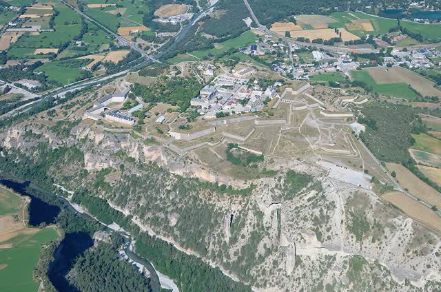
The route passes through Mont-Dauphin, an entire fortress town that Vauban built from scratch in 1693 on a plateau at 1,050 metres. A year earlier the Duke of Savoy had raided the valley with forty thousand men and burned the settlements around it, and Louis XIV wanted something to block the road from Italy. They designed it for two thousand soldiers and two thousand civilians. The church there was never finished. Today it is on the UNESCO heritage list.
We left town and started climbing. We met a dog on the way and reached the campsite. We had bought the steaks at midday so we could grill them in the evening, and it turned into an incredible meal.
Another really long day, 34 kilometres.
Mont-DauphinCarsten Steger · CC BY-SA 4.0 · Wikimedia Commons
Day 17August 3
The dog that joined us, and the restaurant that opens at seven
Started at
Through
· · · · · · · · · · · · · · · · ·
Finished at
We started the day walking on a road, crossed a stream and began the first climb.
On the way a dog joined us and walked with us for a while. We made porridge for breakfast with a sandwich and coffee.
At the top of the climb we reached a rifugio — and it was closed. That really got to us. Instead we saw a lot of cows, and it was a bit frightening to walk between them because they all had calves.
After that we got into thick brush, and in the village on the way there were garden gnomes everywhere.
We finished the descent and reached a restaurant, but we had to wait until seven in the evening just to eat. After that we had a generous meal, 43 euros each.
A relatively short day — we finished walking by four.
Day 18August 4
The Swiss guy who made us coffee
Started at
Through
· · · ·
In the morning we met a Swiss guy who made us coffee. Nice bloke, we talked for about half an hour.
After an hour and a half of walking we stopped for a generous breakfast — porridge and sandwiches.
From there we climbed to the pass with everything we had and dropped down to the town. We had lunch and played chess. There were cows in the way that gave us trouble, but we got past them.
We had carried a large bottle of beer with us the whole way. We cooled it in a stream and drank it with crisps, facing an insane view.
After that we started cooking — salad, and ptitim with tuna that came out really good.
A tough day full of climbing: 34.6 kilometres and 2,000 metres of ascent, on the edge of the Écrins national park.
Day 19August 5
The donkeys that carry the supplies up
Through
· · · · · · · · · · ·
Finished at
We woke up to a crazy view, drank coffee and started climbing straight away.
We have been in France a few days now, and I have to say the climbs here are much gentler and it is much easier walking. Or maybe we have just got fit after 19 days.
We reached the pass and came down for a few hours to a village. On the way we saw the donkeys that carry the supplies up to the huts — that is how food reaches the refuges that have no road to them.
In the village we played chess and had an incredible, indulgent lunch, 27 euros a head. We left full and happy and started climbing, and I felt like I had eaten too much and could not walk properly.
We reached the second pass and came down to a village. We went into a few refuges and they said they had no space, not even to lay out a sleeping bag outside. So we found a nice corner by the stream, cooked dinner, played chess and went to sleep.
A relatively short day compared to yesterday.
The Vanoise, and Mont Blanc
Day 20August 6
No signal, and then a big city
Started at
Through
· · · · · · ·
Finished at
We slept in an area with no phone signal, and it was actually great. We played a lot of chess and I got through a book — I brought an e-reader with me, and it is the most convenient thing for trips like this. We went to sleep early, and we slept low down so it was warm.
In the morning an 800-metre climb up to the hut, and we took a three-hour break there. We were really hungry because we had not eaten anything in the morning, so we decided to treat ourselves: two drinks each, a starter, a main and dessert. 30 euros.
After that we came down out of the mountains into a really big city. We found a park and knew immediately we would sleep in it. There were people there playing pétanque, the French game with the metal balls.
We finished our shopping at the supermarket, ate steaks, salad and fruit — another 30 euros a head. We went to sleep satisfied.
Day 21August 7
27 degrees, and a slackline in the middle of a park
Started at
Through
· · · · · · · · · · · · · · · · · · · ·
Finished at
We started at a local bakery — nothing beats French pastries. We sat there for an hour, played chess, and then set off.
The hottest day we have had so far, 27 degrees, because we were walking through really low ground. Most of the walking was in exposed fields with no shade. After about 15 kilometres we stopped for breakfast in the shade, and it gave us plenty of energy to carry on.
On the way we found a slackline someone had left up in one of the parks, so obviously we got on it.
Then the climb started — long, in the heat. We passed a horse farm, and then we saw a waterfall. We got in to cool off, and while we were there we did laundry and dried the clothes. A long break, and then back to the climb. Someone we met there told us the view at the top is one of the most incredible in the area, and he was right.
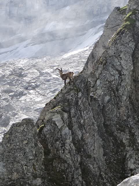
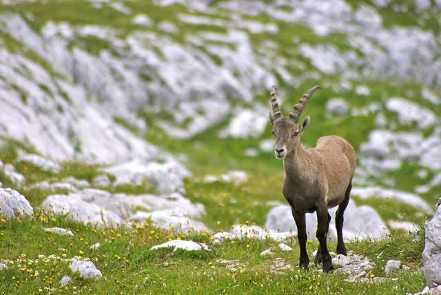
For the night we reached the Refuge du Plan du Lac, inside the Vanoise — France's first national park. They created it in 1963 mainly because the ibex had almost disappeared from the area. We made dinner and bought a litre of wine, which works out much cheaper than beer.
30 kilometres, 1,500 metres of climbing.
Alpine ibexIbex73 · CC BY-SA 4.0 · Wikimedia Commons
Day 22August 8
We got lost, and reached our highest point
Started at
Through
· · ·
Finished at
Today we got lost.
We started on the trail, but it forked, and I was sure I knew which way. We were just mesmerised by the valley — mountains and glaciers on every side, streams running, and marmots everywhere.
Somewhere in the middle we realised it was not the right direction. We opened the map and started looking. We reached a hut, asked for a map, drank Coke and ate cake, and planned a new route.
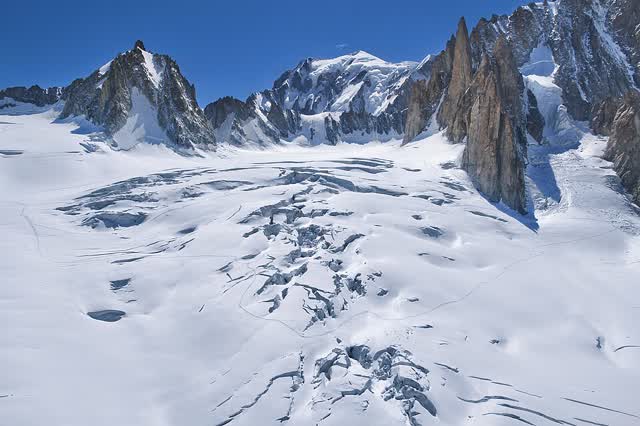
And the new route took us to the highest pass we had done up to then, 2,911 metres. From there we saw Mont Blanc, the highest mountain in Europe. At some point I want that one too.
We came down, and all the frustration about going wrong just passed.
The descent carried on down to the town, and there we did the most expensive resupply of the whole route: 171 euros. We looked for a lift back to the point where we had gone off course and could not find one, so we took a taxi. The driver said this is the most expensive area around.
We bought steaks and wine, made a salad and ate. A long day, but we were back on route.
Mont BlancXimonic, Simo Räsänen · CC BY-SA 3.0 · Wikimedia Commons
Day 23August 9
Mushrooms passed down in the family
Started at
Through
· · · · · · · ·
After a late night we indulged in a lie-in and only started walking at eleven. Our latest morning.
From the campsite there was a really steep climb. We came out of the valley and saw incredible rocks and caves, crossed a few beautiful streams, and then all the snow-covered peaks opened up in front of us. We went through a few small villages that looked like nobody lived in them. We stopped for a short break and ate pastries with jam.
In the forest there were loads of people picking raspberries and mushrooms. We asked the mushroom pickers how they know what to pick, and they said it has been passed down in their family for years. Lucky that Azri likes picking mushrooms too.
We carried on up and reached a hut, and there we got an unpleasant surprise. We asked where we could pitch a tent and the guy said nowhere — which sounded strange, because every hut up to then had had an area set aside for it. We carried on a bit, pitched the tent at some spot, and the moment he saw us he ran over and shouted at us to go to the lake. The lake was about a kilometre back. He could have just said that from the start.
In the end we found an excellent spot by the lake, cooked inside the tent and ate well.
A relatively short day because of the late start, but sometimes we deserve that too.
Day 24August 10
The 77-year-old Frenchman
Through
· · · · · · · ·
Finished at
Two passes today, and on one of them we could not find the markings at all — we just zigzagged our way up to the pass.
On the way we met a 77-year-old Frenchman doing exactly the same trek. Except he is doing it in far more comfort: sleeping in a hotel every night and spreading it over six months instead of three. And he is about to finish.
The views were incredible, every peak covered in snow and every stream running. The Col du Mont is the border, and from there we came down back into Italy, into the Valgrisenche valley. We passed a few farms and filled up with water at one of them — the farms here look really cool.
After that we walked on paths where you have to watch every step, because putting a foot in the wrong place means a serious fall. We had a lunch of porridge with lots of sweet things in it.
Later we came off the trail and hit a really steep section we had to climb. It was honestly a bit frightening, but we got through it.
We decided to cut the day short because we had not showered in four days and the clothes really stank. We stopped by a stream in the forest and showered there. For dinner I made our favourite dish — couscous with onion and tuna.
Day 25August 11
The Italian with the two beers
Started at
Through
· · · · · · · · · · · · · · · · · ·
Finished at
This felt like the hardest day we have had so far. Partly because it was really hot and we were low down, so the sun was on our heads all day, and partly because the climbs were really steep.
We started with a small climb and then came down to the town. We stopped halfway for breakfast, and a local saw us sitting and eating — and then just appeared out of nowhere with two beers. Nothing beats Italians.
We carried on, it got really hot, and we cooled ourselves off in the streams. Halfway up the climb we found a small place selling ice cream and Coke, and they even made us a sandwich at a really cheap price. A bright spot in the middle of a climb. We kept climbing, still hot, so we stopped for ice cream again. The view was worth it.
On the way we met a group of Italians hiking in the area for four days. We sat and talked with them, great people. After that there were more climbs, and one section where we had to use ropes.
And we reached the hut. The moment we arrived they saw the big packs and asked if we were doing the Via Alpina. For anyone who does not know it — that is the name of the route I am walking. A network of marked trails that crosses the entire Alps through eight countries, and what I am doing is the Red Trail, the longest of them, from Trieste to Monaco. I am just walking it in the opposite direction. We said yes, and straight away they gave us free laundry, a discount on the food, and even let us use the staff showers. It was the place with the best treatment on the whole route.
We ate a huge meal, played chess, and the whole thing cost 30 euros a head.
Day 26August 12
The flag we wanted
Started at
Through
· · · · · · · · · · · · · · · · ·
We opened the morning at the hut, coffee and cake, and started walking early — at eight — towards the first pass. On the way we ran into cows, and one of them licked Azri.
We reached the pass at 2,482 and met some French people there. In the morning we managed to dodge the sun, but at the top it finished us off.
We came down to a town — a descent we felt in the knees, but it was worth it. We went into the supermarket, drank a lot of Coke and had a lunch of sausages and pesto. I finally had signal, so I edited a few videos from the last few days.
These last few days the heat hits 30 degrees at midday and you have to stop. We took a break to freshen up, washed our faces at the taps along the way and carried on up.
And finally we saw the flag we wanted — the Swiss flag. We reached an incredible spot on the border between Switzerland and Italy, and stopped there for coffee and cake.
From there we came down into a valley with a running stream, to the lake where we stayed the night. We made dinner, read a bit and fell asleep straight away.
A challenging day. My GPS went haywire halfway through, but we got past it.
Switzerland
Day 27August 13
Two hundred shekels on snacks
Through
· · · · ·
Finished at
We woke up by the beautiful lake we had slept next to, and packed up quickly because we had nowhere to fill water. We came down to the first town, and passed stunning streams on the way.
And this was our first supermarket in Switzerland. I have to say — it is really expensive. We bought a few snacks and something for breakfast, and it came to about 200 shekels. In France or Italy it would have been maybe 100.
We carried on, crossed more streams, and were in a really beautiful valley with green and mountains on every side. The whole morning was downhill and relatively flat ground, really enjoyable.
For lunch we bought food — and the ice creams alone came to 30 shekels. Prices like back home. We took sausages and cheeses and made sandwiches. Afterwards we climbed up to the lake, bought more for dinner, and another 130 shekels.
In the evening we put together a generous meal — vegetables, mash, tuna and sausages.
For the next few days we are in Switzerland, and we will try to get through it as fast as possible so we do not spend a lot of money. Because the way it looks, if we keep eating here we will go broke.
Day 28August 14
The busiest section on the route
Started at
Through
· · ·
We slept by a stream. I like falling asleep to the sound of running water — it helps me drop off.
We opened straight into a thousand-metre climb from Arpette towards the Fenêtre d'Arpette. Green in every direction you look, but the climb got steeper and steeper. Towards the end it turns into a steep boulder slope where you cannot really see where the path is, and you need your hands too. We got through it.
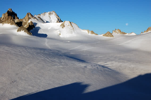
At the Fenêtre d'Arpette, 2,665 metres, everything opens up at once: the Glacier du Trient right in front of us, snow-covered peaks all around, and streams running below.
It is also the most touristy part of the route. This pass is the highest point on the Tour du Mont Blanc — the hard variant of the stage from Champex-Lac to Trient — and there were loads of people there. A bit of a shame, but the beauty makes up for it.
We came down to Trient, ate breakfast and carried on. And then it started raining. Azri put on a layer, and I actually wanted to walk in the rain uncovered to freshen up — it was still 27 degrees, so it was pleasant.
On the way we saw a wooden tower that looked cool and a few donkeys. We came down to a village and went into a pizzeria, and the prices are high: 34 francs. Their currency is a bit more expensive than the euro.
In the end we reached a stream near Gueuroz, pitched the tent and put the covers on, because it is meant to rain overnight.
Glacier du TrientPoschi · CC BY-SA 3.0 · Wikimedia Commons
Day 29August 15
Two thousand three hundred metres, and a holiday that closed everything
Started at
Through
·
Finished at
We started at Dorénaz, in a really low valley, and from there climbed through Allesse and La Giète. 2,300 metres of ascent — the most we have done so far. Only 24 kilometres, but we felt every one of them in the legs.
We had hoped to eat lunch at one of the huts, but it was a holiday in Switzerland and everything was closed.
Switzerland is divided into cantons. It is not quite a province — each canton has its own laws, its own taxes and even its own calendar of holidays, so a day that is a holiday in one can be an ordinary working day in the one next door. We were in Valais, and there 15 August is the Assumption, and everything that closes on a Sunday was closed then too. So at midday we cooked what we usually eat in the evening: mash and sausage.
We gathered our strength and carried on climbing, and then the whole valley we had crossed opened up behind us. We could see the snow-covered summit of Mont Blanc and all the mountains we have crossed so far, and we could even make out Lake Geneva.
Along the way there were whole fields of blueberries. We picked a handful and ate them, and they were really good. Crazy to think what that costs in a shop compared to what we gathered in a few minutes.
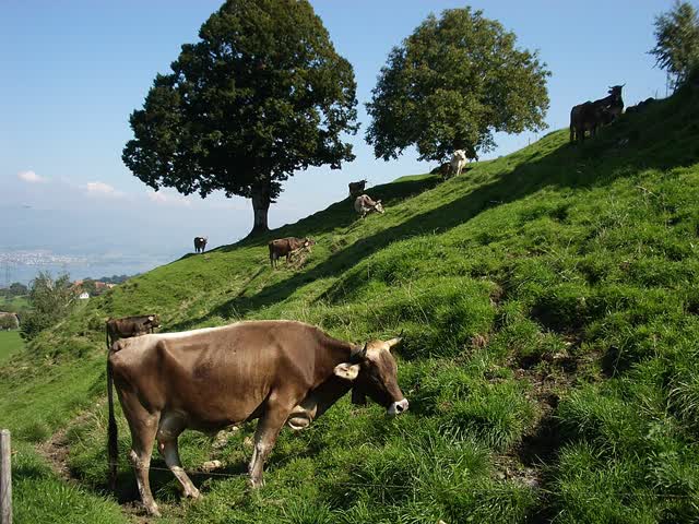
We also saw cows with long fur that live at altitude, Highland cattle.
In the end we found a hut that was open exactly when we needed to eat, so we treated ourselves to fondue. Honestly it was a bit disappointing, because they did not bring enough bread with it.
And my sock tore. I hope there will be a sports shop in the next few days.
Highland cattleNo machine-readable author provided. Paebi assumed (based on copyright claims) · CC BY-SA 3.0 · Wikimedia Commons
Day 30August 16
How we eat
Through
· · · ·
Finished at
We ran out of all our food yesterday, so after today's climb we came down to a town. It is a detour, but without it there is nothing to eat.
When we resupply we buy at least a week's worth — snacks, breakfasts and dinners — so we do not have to rely on the huts. Simply because it is much more expensive there: getting supplies up to the high huts is hard, and even a bottle of water can cost 15 euros. And in Switzerland there is the franc, which is a bit more expensive than the euro.
How it works. In the morning you get up, coffee, and bread with spreads — jam, chocolate or peanut butter — and a few nuts. At midday you stop for a quick snack, something that will hold for a few hours. And the easiest, fastest dinner is couscous or mash, because the water-to-food ratio there is one to one — and if you are stuck without a water source, that is what pays off most. You always add sausage or tuna. Everything goes in the pot together, you stir, and out comes a king's meal.
Today the route was steep. We crossed the Col des Perris Blancs, came down to Pont-de-Nant, climbed again to the Col des Essets and finished at Anzeindaz. On the way we crossed a few streams, stopped at a few huts to eat and played with dogs.
And every day we shop we also buy something indulgent for that evening — steaks, vegetables for a salad. Something to break the routine.
Obviously we could save a bit of weight. We would rather be full.
Day 31August 17
T3, and we did not know it
Started at
Through
·
We slept somewhere with no water and ran out, so we got up and had to go straight down to one of the huts. On the way we went through fields full of cows, and Azri — who likes to pet every animal he meets — got a solid round of licking from them.
We came down to a stream, found water, saw a lake, filled everything up. We thought we were ready for what came next.
We were not. The climb that followed was so steep that we walked it on our toes so as not to fall backwards, and part of it we simply climbed with our hands. There were iron bars and ropes to hold on to, and even ladders.
And in Europe there is a grading for this. The routes are rated: T2 is an ordinary walking path where everything is fine; T3 is already demanding — steep climbs where you have to use ropes, ladders and iron rungs. That is what we did today, without knowing in advance. We also saw signs for T4 along the way, and luckily we did not have to go into it.
We carried on, saw animals, crossed running streams and reached a hut for coffee and pastry.
And to finish, a tip: we tried tinned meat today. Do not try it. Both the taste and the smell are like cat food.
Day 32August 18
How much space they have
Started at
Through
· · · ·
Finished at
A hot day with two passes.
On the way we met two guys doing the same route in the opposite direction. They are on day 63 and due to finish in five weeks — taking their time, because with European citizenship there is no visa pressure. We do not have that luxury.
After the first pass we stopped for a generous meal. We saw animals there we had not seen before, and we ate a lot.
By the afternoon it was really hot and we started climbing to the second pass. Incredible views the whole way, mountains and green in every direction. What struck me is how much space there is here — a house, then three or four dunams, then another house. It is nice to look at.
On the descent we ran into a cow and a goat scrapping right on the trail, so we had to go around them.
Because of the long breaks we only arrived at half past eight in the evening and did everything in the dark. We drank a bottle of wine, ate well and went to sleep.
Day 33August 19
A downpour, a salamander and new shoes
Through
· · · · ·
We started with a climb that had streams running the whole way up it, and at the top we saw something we had not seen before: people flying radio-controlled gliders, riding the wind that comes up the slope.
We also saw cows with long hair and huge horns. And in Switzerland you constantly see the cable cars moving people from place to place.
After a long walk we reached a town and made a breakfast of porridge and fruit. And I changed shoes. The old ones were finished — they lasted almost half the route, and that is completely fine. Coffee, cake, and on the way up we saw an Israeli flag hanging at one of the huts. That was cool.
And then the rain started. A downpour that did not stop and soaked us completely, but at least we had time to cover the packs. We pushed on to the pass, and could barely see anything through the fog.
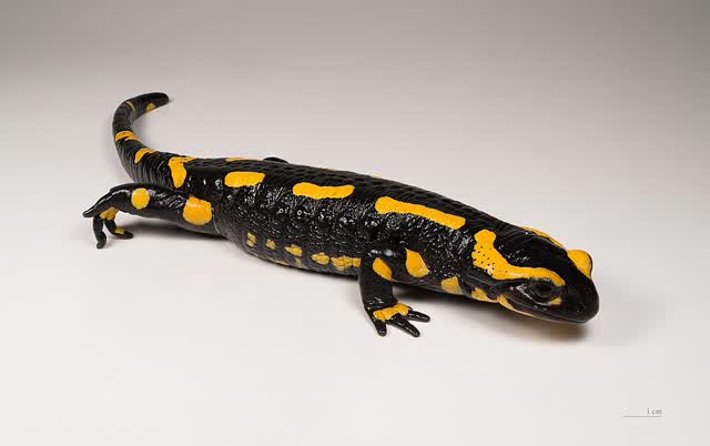
On the way down we saw a salamander. According to Azri it is rare to see one.
We found a good place to sleep, made a generous meal and finished.
Fire salamanderDidier Descouens · CC BY-SA 4.0 · Wikimedia Commons
Day 34August 20
We parted by the lake
Through
· ·
Today we split up, and from here I carry on alone.
We started the day together. It was sunny, it was fun, we went to eat at a café and treated ourselves to a load of pastries. From there we started climbing towards the Oeschinensee.
The weather started deteriorating minute by minute. I made the decision to carry on, and Azri said he was stopping. We had a last meal together and said goodbye.
And then I set off on a new journey of my own, alone. It is frightening and exciting at the same time — to see how I manage on my own in all this mess. A bit of time to be with myself, to think, and to develop on my own.
On the climb up there was a downpour. Not rain — a downpour.
I got to the top exhausted and without the energy even to film. Luckily there was a hut at the pass, at 2,800 metres, and that is where I finished the day.
OeschinenseeJoachimKohler-HB · CC BY-SA 4.0 · Wikimedia Commons
Day 35August 21
The day I descended the most
Started at
Through
· · · · ·
Finished at
After a night in a hut at 2,800 metres I got up early. It was meant to be a very rainy day, and luckily I got a window of a few hours of good weather in the morning.
A very long descent was waiting for me, and after it another pass, and from there a descent to the town. Most of the way I walked inside the clouds, and now and then they opened and gave me a view. Because of the rain the streams were running hard. It was still cold, so I carried on without breaks until I dropped to a more comfortable altitude.
And then the landscape started changing — much greener, orchards and trees. That is always a sign you are descending, and it is always a good feeling.
36 kilometres. My longest day so far, and also the one with the most descent.
Because I barely stopped in the morning, I reached the town by three. I did laundry — 5 francs, about 22 shekels — and finally all the clothes are dry after the rain. I bought lunch, treated myself, rested a few hours and then went looking for somewhere to spend the night.
And since Azri left, the tent went with him. Since then I sleep under the open sky, and if there is rain I look for a sheltered spot along the way. That is what has led me to sleep in interesting places — like tonight, a bench in the middle of a walking path on the way up into the mountains. You also have to be careful with camping spots, because every country has its own rules, and it would be a shame to get caught and fined, which can run to hundreds of shekels.
Day 36August 22
Under the Eiger, in the clouds
Started at
Through
· · · · · ·
Finished at
I started straight into a climb. I wanted to reach the town and eat something good, so in the morning I just snacked on bread and sausage and set off.
The longest day so far: 38 kilometres and 2,300 metres of climbing.
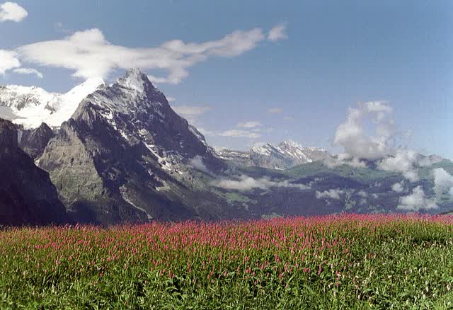
The route goes through Kleine Scheidegg and Grosse Scheidegg, on either side of Grindelwald — and above the first saddle stands the north face of the Eiger, one of the most famous walls in climbing. It was overcast all day and the clouds hid the mountains, so I did not see it.
What I did see was a lot of snow-covered peaks, and I was surprised there is snow in these areas right now. The mountains here are not that high, three to five hundred metres above the passes I crossed, and still there is snow on them. Not on the passes themselves.
I reached a town sitting in the middle of a valley, the kind where you can see all the mountains around you. I stopped at the supermarket, bought a few things and carried on. I reached another pass, and suddenly a beautiful stream appeared that I walked alongside.
I also bought olives and did not realise they were vacuum-packed — they turned out good. I made mash with tuna and onion, one of my favourite dishes.
A really enjoyable day. A long walk, and not as hard as I expected.
The north face of the EigerTinelot Wittermans · CC BY-SA 3.0 · Wikimedia Commons
Day 37August 23
The Swiss fridges
Through
· · · · · · ·
A long day but a good one. I broke the distance record again — 41 kilometres, more than planned, because I had to reach shelter at the end.
In the morning I snacked and went down to the town, stopped for coffee and a pastry and carried on.
And one of the things that surprises me most here, especially in Switzerland: there are fridges along the way for hikers. Some are just cold water you can drink, and some are an actual fridge — you take what you want, leave money, and carry on. With nobody watching.
I am not sure a thing like that would survive back home, and that is a shame. There is nothing like taking something cold after two or three hours of climbing.
Today's climb was 1,800 metres, and then I got onto the ridge and walked along it. Loads of lakes, loads of snow-covered peaks. The clouds hid most of them, and what did open up was stunning.
After the first pass I carried on along the ridge, dropped down for a coffee and pastry break, and then another small 400-metre climb and a long descent to where I was sleeping.
I finished late. I took long breaks in the morning and at midday because I wanted to indulge, and it was worth it.
Day 38August 24
First shower in two weeks
Started at
Through
· · · ·
Finished at
I started at Engelberg, an incredible town in the middle of Switzerland with routes heading out in every direction.
Most of the day I walked alongside a stream. A gentle but very long climb up to the Surenenpass, at 2,300 metres. Snow-covered mountains the whole way, and cows and horses along the route.
After a few hours I stopped for the lunch I had bought that morning — sausages, cheeses and jams for energy. Then I carried on to the pass.
I was so happy to finally reach it, and then it turned out a very long descent was waiting for me. I had not expected that.
The legs are starting to feel the load. I have covered over 35 kilometres on each of the last four days. And there were almost no water points along the way, which was tough.
But I pushed on and finally reached a room. First shower in two weeks. I ate a huge, indulgent meal I had been fantasising about for ages — 55 francs, and worth every penny.
Day 39August 25
A treehouse
Started at
Through
· · · · ·
Finished at
I started with a long descent to the town where I planned to resupply and eat lunch. On the way I crossed a lot of streams, and reached Linthal — a small town with barely one supermarket.
I gave in to a few too many cravings. I bought too much, ate loads of cornflakes and loads of ice cream, tried their hot dish, and in short ate a very large amount. Afterwards I had to rest for an hour.
And then an 1,800-metre climb in one go was waiting for me. Halfway up I stopped at a farm, they brought me a Coke, I ate some of my lunch, gathered my strength and carried on to the pass. The view from there was stunning.
From there I started descending, and finished relatively late.
And I found a small treehouse. It gave me shelter from the rain and an excellent place to sleep. I am travelling without a tent, so sometimes I have to work around the weather and look for places that suit.
Tomorrow I reach Liechtenstein.
Day 40August 26
Two sets of clothes
Started at
Through
· · · · · ·
Finished at
I slept in a hotel, something I had needed for a long time, and had a generous breakfast there. After a few kilometres I stopped and did laundry.
I walk with only two sets of clothes — one clean and one dirty — and I always try to keep the clean one for an emergency. So on a sunny day like today, you have to wash.
All day I walked at an easy pace with plenty of stops. I got onto a ridge from which you can see the whole valley and all the peaks around, and I saw people working in the orchards — green in every direction.
Later in the day I recorded a podcast, so I took a long break. I was pretty nervous, but I think I spoke well. I also stopped a few times to film and got the drone up.
Now that I am alone, I try to call a friend every day. To talk a bit, catch up, pass the time. Walking alone all day is fairly boring and lonely, and sometimes it is hard. But you meet a lot of people along the way and get into a lot of small talk with other hikers, and in the end you find things to do. The change from walking with friends to walking alone was hard, but I have got used to it.
At the end of the day I walked along a stream looking for a spot to sleep. In the evening, couscous with sausage and onion.
I have about another month.
Day 41August 27
Last day in Switzerland
Started at
Through
· · · · · · · ·
Finished at
My longest day so far — almost 43 kilometres.
I started with a descent to the town, stopped there for a short break and ate fruit and vegetables. Then today's climb, 1,500 metres in one go — long but gentle. In fact the whole day was gentle, and that is exactly what let me walk so far.
I saw cows and goats on the way and reached the pass at 2,300 metres. From there I descended alongside a beautiful stream, with loads of waterfalls along the way, and passed through a few towns.
This is my last day in Switzerland. On the way down I stopped at a hut and ate soup and pasta — those meals really give you strength. And I also had to use up all my cash, because tomorrow we go back from the franc to the euro.
I finished the day with a stunning sunset, with the whole town spread out below me. I walked a bit in the dark and found a place to sleep.
Tomorrow is meant to be a rainy day.
Liechtenstein, and into the Allgäu
Day 42August 28
Liechtenstein, 53 kilometres
Started at
Through
· · · · · · ·
Finished at
I slept next to a main railway station, under a bridge. To tell the truth, it was a bit stressful, and the sleep was not one of the better ones. But I managed to get up early and start walking at seven, before the rain.
After two hours I reached the border with Liechtenstein. Not really a border — two signs saying which country starts where.
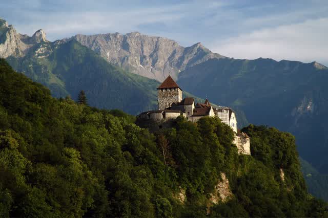
A few facts, because most of us probably do not know it. Liechtenstein is 160 square kilometres — less than Rishon LeZion and Tel Aviv combined. It is a real principality, and the prince lives in a castle overlooking the capital, Vaduz, which itself has fewer than 6,000 residents. It has no airport: you can only get in through Switzerland or Austria. And despite the size it is one of the richest countries in the world.
And despite the rain, it was one of the most beautiful days I have had. I got onto the ridge that crosses the country, and the moment I reached the top the rain simply stopped and everything opened up in front of me.
The route itself was ladders, ropes and walking along cliffs. For anyone with a fear of heights it could be a problem. For someone who likes a bit of action like me it was exactly what I needed after the last few days.
I strongly recommend giving Liechtenstein two or three days. A small country with a great deal of beauty.
I finished in sunshine and carried on into the dark, very late, because without a tent I have to keep walking until I reach somewhere I can actually sleep. 53.7 kilometres. The longest I have done.
The castle above VaduzMichael Gredenberg · CC BY-SA 3.0 · Wikimedia Commons
Day 43August 29
After fifty-three
Started at
Through
· · · · · ·
After the longest day I have had, I felt it in the morning. I got up late and let the body rest properly. The body always wakes up a bit seized up, but after walking a while it warms up and everything gets better.
I reached a village and bought as many pastries as I could. I opened the morning properly.
On the way I saw a sticker for the Jerusalem Way, and it turns out there is a trail here in Austria by that name. I looked it up afterwards. Three Austrians started it in 2010, and it runs from Finisterre in Spain — the point once considered the end of the world — all the way to Jerusalem. Around 8,500 kilometres through fifteen countries, and the Austrian section alone is about 860. They call it the longest interfaith pilgrimage route in the world. Strange and beautiful to see a sticker pointing home in the middle of a forest in Austria.
I barely saw anyone all day, but I went through loads of villages, and saw all the peaks and the fields around. I stopped for ice cream — that Magnum is in my top three of the month, maybe even competing for first place.
I walked alongside a very large stream.
And today there were loads of closed supermarkets. They have a thing in Europe about closing between 12:30 and 4, and it is pretty annoying when you arrive exactly in those hours. Luckily I always keep hot meals for emergencies, so I drank tea and ate one of them at midday and that took care of my appetite.
When it started getting dark I picked up the pace, and in the last half hour exactly a drizzle started. The forecast said it would be raining all day, so I got off lightly.
In the end I took a hotel for 93 euros. I ate soup and drank a few beers. I wanted to treat myself, because it had been a mentally hard day and I had struggled a bit with the walking.
Sometimes there are days like that, and it is all fine.
Day 44August 30
I crossed into Germany without noticing
Started at
Through
· · · · · · · ·
I started late. I let myself indulge at the hotel and only set off at eleven, and that is what led to me finishing in the dark.
But it was not only because of the hour. In the area I was walking through there was almost nowhere to sleep — full of cliffs, no flat ground. I spent a long time looking.
Because of the rain over the last few days there was mud along the entire route. It made the walking harder and soaked my feet completely, and all the streams were running hard.
It was only on this trip that I noticed how much the weather affects your mood. After a few days of rain the sun suddenly came out, and it lifted everything. It is a pleasure to travel when everything around you is lit up and you can see.
I finally reached a supermarket and bought two days' worth of supplies — 57 euros. I took a long break, ate a few hot meals and an avocado, and a Magnum for dessert.
And today I crossed into Germany without noticing at all. I only found out the day after.
I reached the Koblatpass and walked with a headtorch for a while until I found a corner. Not the most comfortable place to sleep, but I managed. There are days like that.
42 kilometres and 2,900 metres of climbing — the most I have climbed in a single day.
Day 45August 31
Last day in Germany
Through
· · · · ·
In the morning I reached Oberstdorf, one of the southernmost towns in Germany. I did laundry because it was sunny, and ate breakfast.
For anyone who wants to walk in this area: there are routes here for every level, of one, two, three or four days, and everyone can go at their own pace. And if you do not fancy climbing that much, there are cable cars that take you fairly high and from there you can do a few hours' loop. I can make less use of them — I have to climb everything on foot.
I saw loads of green and mountains all around, and I managed to finish exactly at sunset.
In nature-reserve areas it is harder to find somewhere to sleep, because it is not always legal and there are specific zones where it is allowed. So you have to plan the day a bit further ahead. Luckily I reached one of the huts in time and slept close to it.
This is also my last day in Germany. Tomorrow I go back into Austria, and that is a bit of a shame — this area looks really beautiful and I am sure I will come back to it.
OberstdorfUnknown authorUnknown author · Public domain · Wikimedia Commons
The Zugspitze, and on to Innsbruck
Day 46September 1
The GPS lied to me
Started at
Through
· · ·
Finished at
I slept in the reserve, and in the morning I started with a climb and reached a stunning pass. I even managed to catch the two hours of sun there were today.
From there a lot of descents and climbs, forests and views.
My GPS went haywire today. It logged 52 kilometres, and in reality I walked more like 35. Anyone looking at the numbers should know.
After a few hours I stopped for lunch. Some of the places I pass through have small shelters you can rest in, and that is exactly what I did — I ate my standard meal on the move, bread with peanut butter and jam.
Then I reached a very large stream and walked alongside it. That was good.
I reached the town pretty finished and had to resupply — I bought two days' worth and drank coffee with a pastry, my usual.
And then it started getting rainy. I looked for somewhere for the night and found a small abandoned hut where I could sleep under cover. I made steaks for dinner and drank a beer.
Day 47September 2
Mud, slick rock and a trail that collapsed
Started at
Through
·
A rainy morning, and it was really hard to get up. I let myself linger a bit. Getting up and starting to walk straight into rain is not the most enjoyable thing.
The further I walked the weaker the rain got. The mountains were washed and beautiful after the rain — but rain also leaves a lot of mud and slick rock, and on days like that my pace is much slower.
I reached a really cool hut. If I had not been in a hurry, I would have stayed to sleep there. This trip gives me a taste of every part of the Alps, and it only makes me want to come back to each one separately.
After a lunch break I came down to the town, and then the main climb started: 1,200 metres, to close out the day. At first through forest, all fine and beautiful, and then it got really steep.
Parts of the trail had simply collapsed because of the rain, so I had to be much more careful. Every time I looked back I was amazed by the beauty — while trying not to fall.
I walked fast to find a spot before dark, and reached two thousand metres. I passed clear lakes in the heart of the mountains.
I found a quiet, fenced corner, even with a bench. I cooked there at my leisure facing a view you can go to sleep to and wake up to.
Day 48September 3
Beside the Zugspitze, seeing the end of the Alps
Through
· · ·
Finished at
I woke up to a stunning view. It was cold in the night because I slept high, but it was worth it. A generous breakfast, and a sunny day finally after a few days of rain.
And today too, without noticing, I crossed back into Germany.
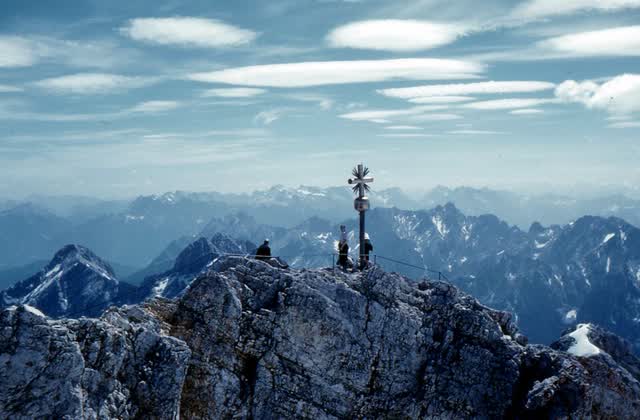
I passed really close to the Zugspitze, the highest mountain in Germany, 2,962 metres. You can reach its summit by cable car, for anyone who prefers that.
It was a day with a lot of ladders and a lot of tough climbing and descending, but the weather was good and it was enjoyable. I stopped for lunch at a hut in the middle of the forest, right on a running stream.
I have to say this is a really touristy area, maybe even a bit too much. It takes something away from the place — but it is still nice to see people rather than walking through an area with nobody in it.
And to finish, the last climb: 1,300 metres in one go, steep, with a lot of ladders and ropes. The view is completely worth it. From the top I could see the whole end of the Alps — exactly where the mountains stop.
I reached a hut at 2,300 metres, a cabin in the middle of nowhere, took a short break and tried to descend as fast as possible before dark. The descent was steep, but I felt good and made it before sunset.
ZugspitzeRoger Wollstadt from Sarasota, Florida, U.S.A · CC BY-SA 2.0 · Wikimedia Commons
Day 49September 4
Do not fill from the stream without a filter
Started at
Through
· · ·
Finished at
A really enjoyable day, with sun most of the day. I set off early, and after an hour and a half I made a coffee stop — why not, with a view like that.
In the town I did my shopping and sorted out everything I needed. Coffee, a few pastries, a Magnum and a Coke, and then I set off.
A gentle day in the forest — I walked in the valley all day, and the views around were very beautiful.
I filled water from the stream, and take note: if you do not have a filter, do not do this. There are loads of cows along the streams here, and you need a filter.
I stopped to talk to a few people at the huts — one from Vietnam, one from Germany. It is nice to stop and talk. I mostly asked them what it is like living in Europe and told them about the trip.
The sun started setting and I started walking faster. It is meant to be a rainy night, so I had to sleep in a rifugio. Great place, great food, great people — and it is nice to sleep in a bed in a room, even if with a few other people. That does not bother me.
Tomorrow is meant to be a downpour.
Day 50September 5
The hardest rain I have had
Through
· · · ·
Finished at
The morning started well, only a few clouds and no sign of rain, so I tried to walk as far as I could ahead of it.
And the moment I reached the high ground for the day, around two thousand metres, a downpour came down on me with really strong winds. The hardest rain I have been in so far. All the rain up to today had been reasonable and you could walk in it. This time I felt that if I stopped I would freeze, and there was nowhere along the way to warm up or take shelter.
And when it rains I cannot take out my phone and look at the map, so it does not get wet. So I walk only by the signs — and that led me to a town I did not need to reach. Luckily it was relatively close to the right town, but it made the route longer.
It surprises me every time how people here go walking despite all the rain and wind, as if it is a normal thing for them. I need to think about how to cope better in the rain next time, and what gear it is worth buying.
After a few wet hours I reached the town, found shelter, dried off and finally warmed up. I took a bus back to the route and ate lunch from the supermarket.
That cold really got to me. It felt like my body was trying to warm itself up and not really managing. So I said right, I am treating myself tonight. I do not want to suffer the whole way — I want to enjoy it too.
And I ate a Wiener schnitzel for the first time. Really good.
Day 51September 6
Do not sleep high
Through
· · ·
After a night in a hotel I opened the morning with a filling meal, took a few hours at an easy pace and set off relatively late. I wanted to enjoy the sun.
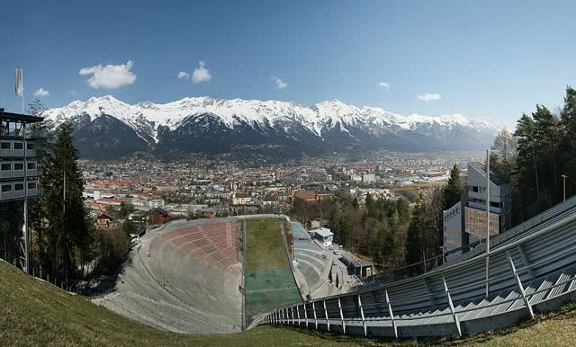
Today there were two thousand metres of climbing, almost all in one go. I climbed from the town up into the mountains — the big city nearby here is Innsbruck.
After a few hours I stopped for a Coke and a coffee, and the sky kept clearing. I climbed high onto the ridge and started seeing all the valleys.
I saw snow on the peaks, and a bit of snow on the route itself. Hikers I met at a cabin said it had snowed on them during the night.
I had lunch there, really good, and then started descending towards where I was sleeping.
A tip for anyone sleeping in the mountains: do not sleep too high or in exposed places. You will be much colder, and it will be much harder to get up in the morning.
I got lucky and found an excellent spot — a cable car station that mostly runs in winter, sheltered from the wind and from everything else. I walked a bit less than I wanted, 27 kilometres, but I finished early.
Innsbruckböhringer friedrich · CC BY-SA 2.5 · Wikimedia Commons
Day 52September 7
The season is starting to end
Through
· · · · · · · ·
Finished at
Another day of sun. I slept at the cable car station and started with a gentle climb from the valley up the mountain, and from there I could see all the snow-covered peaks around.
A few hikers told me it had snowed on them a few nights ago. That is a sign it is already starting to get really cold and that I need to finish the route quickly. The walking season here is coming to its end.
It was still pleasant to walk, and I wanted to make use of the sunny days to cover as much distance as possible, so it turned into a relatively long day.
I stopped for coffee and a pastry. And in Europe, especially in the small villages, they only serve food at certain hours — so you cannot always eat when you want to. Luckily I found a burger I had wanted for a long time, and it gave me energy for the rest.
And another thing worth knowing: their day of rest is Sunday. The weekend runs from Friday through Sunday inclusive, and on Sunday a lot of supermarkets and other things simply do not open. You have to prepare for that.
I found a place for the night in a small village, and there happened to be a concert right next to where I was cooking. I listened to the music while I cooked, and then found a covered spot to sleep close to the village church.
The end is starting to feel close.
The Dolomites
Day 53September 8
The restaurant on its last day
Started at
Through
· · ·
Whenever I climb into the mountains I try to walk as far as I can — both because it is colder at altitude, and because I do not want to be without signal for too long.
Coffee, porridge, and off. I walked in the valley until I reached a large, clear lake, and on the way I saw a lot of climbers. It gave me the itch — I am dying to get back to climbing when I get home.
I stopped for lunch by the lake, a burger and chips, and carried on.
I have not passed through a big town for a few days, so my food is starting to run out and I am buying more at the huts and the restaurants along the way. And that is actually nice — the pack is really light and you can walk further.
I got lucky with the weather, because I was in really high places and in rain it would have got problematic. I was in awe of all the snow around, but it is also a bit worrying: it means the season is ending. A couple of hikers I met said the same thing — the season is about to end and a lot of cabins are starting to close. It only pushes me to walk faster.
After the pass I started descending to lower ground to look for somewhere to sleep, and on the way I happened across a small restaurant — on its last day open for the season. I ate dinner there and treated myself, and instead of starting to cook I just went to sleep.
And I am in Italy again.
Day 54September 9
The guy walking barefoot
Through
· · · · · · · · · ·
The rain was meant to start at midday, so I tried to walk as fast as I could to get ahead of it. Porridge and coffee, and off — a day with only one stop, because I wanted to make it down out of the mountains in time.
I passed through a few high sections at 2,500 metres, and that was not a good place to be caught in rain.
And on the way I saw an older guy walking barefoot. It simply amazed me. It gave me the urge to try it too, but after all the kilometres I have done I think it would not have ended well.
I ate lunch at a nice place, they spoiled me and even gave me a free schnapps. It seems to be a standard thing here — at every meal I eat they offer me a schnapps at the end. You can walk happier afterwards.
I got onto the mountain ridge and set a fast pace, just hoping the rain would not start. Luckily there was only drizzle the whole way. There were parts that were hard to get through, and I did a bit of parkour there — I am used to it by now.
What is annoying about rainy days is not just being wet. It is that everything is overcast and the views never open up, and you walk inside fog. Luckily it opened up now and then, and what I saw was a stunning ridge.
Because I was high up I did not want to stop so as not to get cold, and I do not have much food — so I do not feel the weight of the pack at all any more.
At the end of the day I came off the route to reach a big town. I arrived in the dark, but it was fine because the whole town was lit up. I ate pizza, and found a relatively cheap place — 37 euros a night including breakfast. I took a bus to the hotel.
Tomorrow is meant to be rainy, so I think I am taking a rest day.
Day 55September 10
A rest day, after fifty-five
The first day I did not walk.
Most of the day went on resupplying. I like dividing the food into bags: a bag of dinners — mash, couscous and seasonings — and this time I also bought tinned salmon, which I have not tried yet. A bag of sweets and spreads, jam and chocolate, and I always try to buy them in plastic packaging, because without that I usually skip it. Salt, because I sweat a huge amount and have to replace it. A box with coffee. And a few hot meals for emergencies, in case I arrive finished with no energy to cook.
And today I also used deodorant, after 55 days without. It is pretty amazing. Feels slightly less smelly. Still smelly.
I bought rain trousers and a rain jacket, compact and thin. They cost me 500 euros and it hurt, but until today I had been walking with a poncho and felt it was doing nothing — yes, it protects a bit, but my trousers were always wet. So I decided to change.
I also bought new socks, because all my socks had developed holes at the toes. And new boxers, because I had an incident two weeks ago and had been walking in the same pair since.
Other than that: laundry, loads of food, things for dinner, a few beers. And mostly — resting.
Day 56September 11
Above two thousand there are no trees
Started at
Through
· · ·
After the rest day and another night in a hotel I woke up with loads of energy. Good weather, and after all yesterday's pastries I was ready to give it everything.
The day split into two climbs that together make 2,400 metres. I have got fit. I now do climbs in one go, rest only once or twice a day, and walk three to four hours straight between meals.
I will be honest — it is still mentally hard to know there are a thousand-odd metres of climbing ahead of you in one go. But there is nothing to be done, I try to think only about the next step the whole time. And in the end I both enjoy the view and am glad I am doing what I am doing.
Stunning streams the whole way, and a bit of snow on the peaks around.
From about two thousand metres the trees stop and everything turns to rock. The walking there is completely exposed and you can see all the surroundings. Honestly I prefer the view in the forest — all those rocks are a bit boring. But at the passes and the summits it is always good to see everything.
The sun came out on me right at the end of the climb. I reached the pass and started descending fast before it got dark.
After so many days I have built up a lot of confidence on descents and I do them fast, almost running. It saves me a huge amount of time and lets me walk much further.
I finished at a hotel, because it is meant to be a night of rain.
Day 57September 12
Flat is harder than climbing
Started at
Through
· · · · · · · · · · · · · · · ·
Finished at
I slept in a hotel after another rainy night. 55 euros including breakfast, which is a good price for a town — it is always cheaper in the huts, but after the last few days I have got used to the comforts of a bed.
I got up relatively late, let the body rest, ate a big breakfast and set off.
There was a chance of rain all day, and I managed to dodge it most of the time. The morning was overcast but fairly pleasant, and I started with a long climb — 1,300 metres, and as usual I did it in one go.
After that I wanted to get down fast to the first town I would see, to eat lunch there. On the way I passed loads of huts and all of them were already closed — as far as they are concerned the season is over. The views were stunning, with streams running the whole way.
I reached the town, and the kitchen there was still closed. So I ordered a beer, drank a coffee after it, they made me a toastie, and I was ready to carry on.
Most of the day was in the valley. Relatively flat walking, and for some reason that actually gets harder. I cannot explain why it is harder to walk on the flat than to climb and descend.
Halfway through it started raining and I kitted up in all the new gear I bought. I also met someone who recommended walking with an umbrella — a compact one — and it is actually quite good fun. After a few more hours of walking I stopped at a fast food place, ate dinner there already, and from there just kept walking until I arrived and went to sleep.
Towards evening it turned overcast and rainy again, but it was not bad — I have all the right gear now and I stayed pretty dry. I found a place to sleep. It is meant to rain tonight too, and I am protected from all of it.
43 kilometres, 1,477 metres of climbing, from Anterselva di Mezzo through the Grüblscharte and San Martino in Casies to Schmieden.
Day 58September 13
Alta Via 1
Started at
Through
· · ·
Finished at
I expected rain all day and it never came. Everything was cool and overcast, and it was enjoyable.
I started with a walk to Lake Braies, stopped for coffee and a pastry, and was ready for the day's climbs.
On the way I met two groups of Israelis. It is nice to talk to them. And honestly I thought they would walk faster — I forget that I am in good shape now, and most people do not climb 1,200 metres in one go.
And for anyone who does not know it: the route here is the Alta Via 1, the most famous route in the Dolomites. 120 kilometres that people split over five to ten days, and it also passes one of the oldest huts in the area.
There were stunning views, lakes and mountains. I enjoyed the breaks and made them longer than usual. I met more hikers, some from Canada and Turkey — it is always nice to sit and talk with people from abroad.
I walked along a really beautiful ridge. There is something cool about this landscape with all the clouds and fog. Obviously sun is better, but you take what you get.
Before the last climb I stopped again for coffee and a pastry, and then a short climb and a long descent. I found a campsite, made a generous dinner — the tinned salmon really is good — and next to it there was a place selling beers.
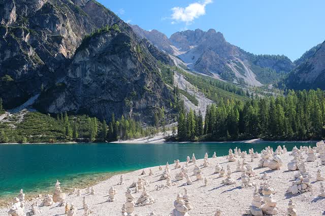
Lake Braieskallerna · CC BY-SA 4.0 · Wikimedia Commons
Day 59September 14
Finishing the Dolomites
Through
· · · · · · ·
A really beautiful day, and the one on which I finished the Dolomites.
I started with a long descent. I had a planned lunch stop in the town so I wanted to walk as far as possible in the morning. After a few hours in a spectacular valley I reached a hut that loads of people set out from for via ferrata and climbing. For anyone coming across this for the first time: via ferrata means "iron path" in Italian — a route where a steel cable, iron rungs and ladders are fixed to the rock, and you move along it clipped to the cable with a harness. So you can get through sections that without it would be proper climbing. Many of these routes in the Dolomites were actually built by soldiers in the First World War, to move around the mountains, and after the war they were restored for hikers. It looks cool, and I have to go back there.
The whole way I walked alongside a stream and saw high peaks. Slowly the sun came out, which is always cheering and gives you energy.
Today's goal was to reach the Carnic Alps — an area sitting exactly on the border between Austria and Italy. That is where my last hard sections are going to be. After that Slovenia, and it is meant to be more pleasant.
I am trying to pick up the pace over the next few days to hit my target — finishing the route in 70 days. That means days of over 40 kilometres, and in this area that is going to be tough.
I stopped to eat and ordered soup. I am not usually a soup person, but in the middle of a day like this a starter of soup gives you loads of energy.
I got onto the ridge I will be on for the next few days and hurried to the hut. The sun started setting, I was inside a huge cloud and you could see the other side of it too. I arrived exactly as the light ran out.
42 kilometres, 2,700 metres of climbing.
Carnic AlpsTigerente · CC BY 4.0 · Wikimedia Commons
The Carnic Alps
Day 60September 15
I left everything at the hut
Started at
Through
· · · · Forcella Cadin · Winkler Joch · Forcella Val Mezzana · · · Walisches Kar ·
Finished at
This is my second day in the Carnic Alps. I got up after a night in a hut, ate a lot, slept well and set off with energy.
The annoying part: after I had already climbed 300 metres up to the pass, I noticed I had left a few important things at the hut. I left the pack, went down quickly to get them, and did not let it ruin my day.
The area here is tough — full of climbs and descents and the trails are not simple. But the views are worth it.
In the morning I got sun, and then slowly the clouds came in and the wind with them. It is crazy how fast the weather flips here — within seconds.
The food at the huts here is surprisingly cheap and also good. I like treating myself at midday: a starter, usually soup, a main of pasta or an omelette, and my standard dessert for the area. It comes to between 30 and 40 euros, I am stuffed and I have loads of energy to carry on.
There were a lot of sections where I had to be careful — plenty of ropes and iron rungs you have to pull on to climb, and that is not the most fun when there is a strong wind. But that is how it is.
I saw loads of sheep along the way. I reached the hut exactly before sunset and went to sleep early.
I woke up in the hut and ate a big meal as usual. The huts here are not expensive — it comes to about 80 euros, and that includes the night, breakfast, dinner and a few beers. In my opinion an excellent price.
At the start of the walk I got caught in rain, and luckily I have the new rain suit. Nothing got in, and I did not feel it was raining at all. One of the good decisions of the trip, and definitely the investment that is worth the most.
After an hour it stopped and the sun came out.
This is already my third day in the Carnic Alps. Everyone has to visit there, and you can do much shorter routes there too. I met four women doing part of the route I am doing, only over eight days instead of three.
And both they and the people at the huts say the same thing: over the next few days they start closing the whole area. End of season, and it is starting to get cold.
On the last climb there was heavy rain, and after it stopped the sun peeked between the clouds for a really beautiful sunset.
I had an especially long day so I walked in the dark too, but I reached a lovely hut with the best treatment I have had. The moment I arrived they made me food and asked if I needed anything — and at most huts, if you arrive after seven, they tell you to sort yourself out.
46 kilometres, 2,900 metres of climbing.
Day 62September 17
Bringing the animals down
Started at
Passo Lodinut
Through
Sella di Cordin · Sella di Aip · · Nassfeldpass · Stutenbodensattel · Sella Zille · Kersnitzensattel
I started in fog and was a bit disappointed, because I had hoped for a sunny day. After an hour the sun came out and from then on I had a day full of sun.
I am still in the Carnic Alps and enjoying every moment. The days are hard, but the body is really ready after everything I have walked.
I passed a few farms and saw pigs and cows. The people there said they will soon start bringing the animals down — most of them have a second cabin lower down, and in winter they move the herd to it. Both so it is more comfortable and because there is usually snow and the access is blocked.
The first section of the day was long, so I only reached somewhere to eat at two instead of twelve as usual. I ate a generous meal — the cheese dumplings were among the best things I have eaten. I do not know why the food here is so much better, maybe because I walk all day and I am hungry.
The weather was good so I took time to film, and I got the drone up too.
And the hut I was supposed to sleep at was closed. It turns out I was not the only one who did not know — a few other hikers were stuck there. But I am used to it by now, so I carried on a bit and found an abandoned hut and slept on the floor.
Today I finish with the Carnic Alps, say goodbye to this border between Austria and Italy, and finally cross into Slovenia — the last country on the route.
I did not sleep in a hut because the place I had planned had already closed for the season. That is a shame, but I was equipped with everything you need for a night outside.
I set off early and without breakfast because I wanted to make good time. I stopped for lunch somewhere with a really beautiful view. The weather has been with me for a few days now — and I have to say that sometimes rain and wind are actually welcome, because it is really hot walking. I keep forgetting that. When it is cold you pray for sun, and when it is hot you pray for rain. I do not think that is only me.
I got to film a lot, with the drone too. I saw a lot of sheep. And it is good to have visibility and see where you are heading, instead of walking inside a cloud.
I also reached the point where the borders of Austria, Slovenia and Italy meet.
I did a long day because I wanted to reach Slovenia already, and finished in the dark. For the last two weeks I have been trying to do days of 40 plus. And the days are getting shorter too — at the start of the trip sunset was at nine, now it is already at seven.
I reached the border in the dark, and from there took a bus to the nearest big town to look for a hotel. I needed to reorganise all my gear. But everything was booked, because there is a huge running race in the area.
The tripointde:Benutzer:Popp · CC BY-SA 3.0 · Wikimedia Commons
The Julian Alps, to the sea
Day 64September 19
The Julian Alps
Started at
Through
· · · · · · ·
Because of the trail race in the area — people running distances from 10 to 120 kilometres — all the hotels were full, so I slept in a car park.
I got up, ate breakfast, and waited for a bus back to the route that was very late. So I started late.
I thought the area in Slovenia would be much simpler. It is not. The trails here are pretty hard. I am now in the Julian Alps, and as hard as they are, that is how beautiful they are.
My goal today was to finish at a hut that people set out from for Triglav, the highest summit in Slovenia, which you need via ferrata to reach. At some point I have to come back here for it.
I had a long walk in the morning with loads of peaks and running streams. A stunning area, and I recommend everyone come.
I ate lunch in a village before the climb to the hut, because I needed energy — and because of the delay in the morning I knew I would finish in the dark.
The last climb of the day was 1,800 metres in one go. The longest I have done. Lucky I am fit enough not to stop.
I reached a nice hut and they immediately brought me loads of food and drink. And one thing worth knowing: the huts in Slovenia have no shower at all. In other countries you can at least pay for one. Here there simply is not one. So I am going to be smelly for the next few days.
TriglavAndrej Jakobčič · CC BY-SA 3.0 · Wikimedia Commons
Day 65September 20
No running water
Started at
Through
· · · ·
Finished at
Another tough, long day, and I did not expect it to be so hard.
I started at a hut with a stunning view. I saw a few animals, and the whole first half of the day went through an area that is all rock. Really, the entire landscape is just stone. I am not sure what I think about that.
Slowly we dropped in altitude and got into forest. It was a day that felt really hot to me.
And I thought water in Slovenia would be as easy as in the other countries. There is almost no running water here. And if you do not have a filter, you have to buy bottles at every hut. Luckily I have one, so I am sorted.
I stopped for lunch, and the views around are stunning.
The last part of the day, after lunch, was much longer than I expected, and it took me into the dark. I walked along a really beautiful ridge, and saw loads of lakes and peaks — and even Triglav, which I was already pretty far from.
I wanted to film with the drone but the wind was too strong and I was afraid something would happen to it.
I watched the sunset from one of the summits. It was really beautiful. From there I carried on in the dark to the hut. Here too there is no shower and here too you have to buy water.
I now wake up on my own at half past six in the morning. The body has got used to it.
Day 66September 21
The best welcome
Started at
Through
· · · · · · · · · ·
Finished at
One of the longest days I have had — over 50 kilometres.
I started at a stunning hut, with a view and a sunrise, and it is really nice to wake up like that. It is the most welcoming hut I have been in. I arrived last night and they immediately started bringing me food and drink, and the owner sat me down with everyone who was there. A Slovenian welcome.
That said — the breakfasts at the huts here are not that good. This is the second hut in Slovenia where I have had breakfast, and it is not a buffet like I have got used to everywhere else. Just a bit of bread with eggs.
I set off early. After a long walk I stopped for lunch and ate Slovenian soup with potatoes. Good.
All day there was a really strong wind along with the sun. The wind blows me sideways, and it has been like that for a few days.
Slowly I am dropping in altitude. Today I finished with anything above a thousand metres — from here on it is between 0 and 900.
And the trails in Slovenia are not the most comfortable and not always clear. But that is how it is.
I passed through loads of villages. And something that struck me: every house here is lived in. I am used to walking in high areas where there are houses and most of them are abandoned. In Slovenia it is not like that — there are people everywhere.
A Slovenian mountain hutCash4alex · CC BY-SA 3.0 · Wikimedia Commons
Day 67September 22
The hardest part
Started at
Through
· · · · · · · · ·
Finished at
After a generous breakfast at the hotel I was ready for a long day. I am counting down the last days, and I reckon I have two left.
The sections here are relatively flat, but they are not the most comfortable to walk.
In the morning I reached Idrija, a fairly large town in Slovenia. It is always nice to pass through a town after a few days in the field — nice to see people. I drank a Coke, bought a few things for the last days and carried on.
The body is starting to feel the fatigue after two weeks of walking at least 40 kilometres a day with at least 2,500 metres of climbing. Slovenia is not simple.
An update on the shoes: they are surviving. They look completely wrecked, but they are still comfortable to walk in.
I saw a lot of orchards and mountains, and passed through villages. But the markings are not clear — there are loads of trails here that fork and do not appear on the map, and it is very hard to navigate. I have to have a phone with battery to know where to go.
I passed farms with loads of goats and cows. It always makes me smile.
And also: in Slovenia everything is closed on Monday and Tuesday. A few places I was counting on for lunch were closed, and luckily I always have something in reserve.
I carried on walking into the dark to cover as much as possible.
This part is the hardest, both physically and mentally. You just want to finish.
Day 68September 23
The last night outside
Started at
Through
· · · · · · · ·
The whole point of today was to walk as far as possible, so that tomorrow I can finish early. Yes, you heard right — the plan is to finish tomorrow.
I slept next to a castle, in a corner a woman showed me last night. I got up early, ate something small and started walking straight away, partly to get ahead of the rain that is meant to fall all day. I have managed to escape it for a few days now, and today too.
This is the last time I walk at 1,200 metres. From here it is only small hills. The walking is not the most comfortable, but at least we are not climbing these mountains any more.
After coming down off the mountain I found somewhere open — on Monday and Tuesday most places here are closed. I ate pizza, carried on, and saw a cute dog on the way.
I passed through all sorts of small reserves in Slovenia, with loads of waterfalls. Nothing beats the Slovenian landscape. As beautiful as it is, that is how tough it is.
By the time I reached a small village in the evening it was already dark, and I ate the biggest meal I have eaten on the route — I tried to get as much food in as possible so I would have energy to carry on in the dark. I walked until around eleven to shorten tomorrow.
I found a spot, and it is the last night I sleep outside.
Day 69September 24
The sea
Through
· · Bottazzo · Bagnoli Superiore · · Rabuiese · Santa Barbara
Finished at
Muggia
The last day. And not simple at all — a hard day both mentally and physically.
The body is wrecked after the last few days, which were long and tough. And mentally I just want to get there already and eat something.
And from the very start of the day you can see the sea. The sea is the finish line.
It rained most of the day and the trails were not comfortable. I got lost a few times because the markings are really unclear — a four-year-old would mark them better. After a few hours I reached the first stop, ate breakfast, and started seeing the city more and more.
I wanted to arrive early so I would have time to do a bit of shopping, because tomorrow I fly home.
So I walked in the rain with everything I had, without breaks. Puddles, water, no water — it does not matter any more. I knew a shower and a hot meal were waiting for me at the end.
I cannot really put into words what I felt. But it really is one of the hardest things I have done in my life. So much joy and sadness. Long days, heat, cold. And it all ends now, at this moment.
I found an all-you-can-eat Asian restaurant and ate half the place. I showered, waited for the bus and travelled to Vienna. The flight home is from there tomorrow.
And finally I can say goodbye to the shoes. I threw them straight in the bin.
Every Photo
238
238 photographs from the trip. Tap one to open it.