Kilimanjaro, safari, and island time across Tanzania, Kenya, Zanzibar, and Uganda.
Dates
July 23, 2024 – September 1, 2024
Duration
41 days
Rating
Difficulty
On the map
Machame Gate — Kilimanjaro · Uhuru Peak, 5,895 m · Tarangire National Park · Ngorongoro Crater · Serengeti — Kogatende · Zanzibar · Nairobi · Sirimon Gate — Mount Kenya · Shipton's Camp, 4,200 m · Batian, 5,199 m — turned back · Samburu National Reserve · Lake Nakuru · Lake Naivasha · Kasese — the marathon finish · Kilembe — Rwenzori trailhead · Margherita Peak, 5,109 m
Recommended season
J
F
M
A
M
J
J
A
S
O
N
D
PeakGoodPossibleAvoid
When not to go
March to May. The long rains are the wettest stretch of the year, and they close the mountains and soak the safari roads at the same time.
Five different activities with five different windows, and June to August is the only stretch where the three mountains overlap.
Kilimanjaro: December to mid-March, and late June to October — January, February, July, August, September and October are the strongest months. Mount Kenya, Batian: the north-side routes are a June-to-October climb, mostly June to August; December to March suits the south-east face and the Gate of Mist instead. The Rwenzori and Margherita Peak: June to August, and mid-December to February.
Safari: the dry season is June to October, and the migration river crossings run mid-July into September with August the peak. Zanzibar: June to October is the dry stretch, and January to February is hot and dry as well — March to May is the long rains and the wettest time of the year. One conflict worth knowing: Zanzibar's best diving is mid-February to April, which does not fit inside the mountain window at all.
A trip through East Africa in 2024 - climbing Kilimanjaro, a safari, time with local tribes, then island time in Zanzibar before continuing on to Kenya and Uganda.
The Map
How to read this map
The dashed line — the route, drawn from documents and photographs, not recorded
Each dot on it — one day. Tap one to see what happened that day
23–24 July · Israel
The flight to Tanzania and the last preparations for the climb. When we landed they picked us up and took us to the hotel — excited to climb my first summit. On 23 July I registered for the Rwenzori marathon, a month before it was due to run.
Day 02July 25
Machame Gate, and into the rainforest
Machame Gate (1,640 m) → Machame Camp (2,835 m)
This is where the trip started. I had no experience of this kind of climbing at all, so I decided to do the mountain with an Israeli company called HighAir. It saved me every headache, and the price I got from them was fair next to what I would have put together myself.
We were a group of Israelis. I was the youngest and the fittest — the average age was somewhere around 40, and one of the guys was over 60. That cuts both ways. The pace comes out slower, but you have interesting company, and you want to help each other and push each other along.
I carried all my own gear for the whole trek. I came in with the view that I don't want to hand the porters my things while I walk with a small daypack — it feels to me like it takes something out of the experience. I want to climb the mountain as independently as I can, so that it's me who did it and not somebody else on my behalf. And so that everything I choose to carry has a consequence, and I learn that consequence the hard way for next time. It's an approach I've kept for every trip since.
Around all of that was a team of locals, about 15 people, who cooked for us and put the camps up. They are what made this thing possible.
Day 03July 26
Out of the forest, onto the Shira Plateau
Machame Camp (2,835 m) → Shira Camp (3,750 m)
This day took us out of the forest. Up to Machame Camp you are inside rainforest the whole time, and then it ends almost at once and opens onto a plateau.
This is where I started seeing the Giant Groundsel — a plant that looks like a small tree with a crown of leaves on top, and is actually a relative of the ragwort. It grows only in the high mountains of East Africa, from around 2,800 m up.
After two days inside the forest, coming out onto open plateau is a sharp change. And those plants looked strange to me at first.
Day 04July 27
Lava Tower, and back down to Barranco
Shira Camp (3,750 m) → Lava Tower (4,630 m) → Barranco Camp (3,960 m)
We climbed to 4,630 m and then came back down to 3,960 to sleep. Climb high, sleep low — that's how the body acclimatises.
Above 4,000 m we stopped drinking coffee and eating meat. We were told the body struggles to digest them at those altitudes, and you have to be careful if you aren't used to them the way the locals are.
Going down after you've climbed all day feels backwards, but it's what works.
Day 05July 28
The Barranco Wall
Barranco Camp (3,960 m) → Karanga Camp (3,995 m)
We set off early. The Barranco Wall is the only section on the whole route where you need your hands as well, and everybody wants to get through it before it fills up.
In altitude terms this day barely moves you — 35 m between the camp we left and the camp we reached. Everything in between is up and down.
It was fun to use my hands after so many days of nothing but walking.
Day 06July 29
A short day to Barafu
Karanga Camp (3,995 m) → Barafu Camp (4,673 m)
A short day. We got to Barafu around midday, ate, and rested — because you leave for the summit at midnight.
A short day was exactly what was needed before a night like that.
Day 07July 30
Uhuru Peak — the roof of Africa
Barafu Camp (4,673 m) → Stella Point (5,756 m) → Uhuru Peak (5,895 m) → Mweka Camp (3,100 m)
Before we set off we had a small meal and packed light food for the way — mostly sweet things, something that would give energy on the climb. We left Barafu at 01:00.
The pace was relatively slow — I'm in a group with people a bit less fit and a bit older than me, and I felt the responsibility to help them and push them up.
I could barely feel my toes. I should have brought warmer socks.
On a walk this long to a summit, what breaks people mentally is looking at the watch the whole time. So I focused only on the next step. Each time I set myself a small target — a point I could see in the distance, and getting to it. And then the next one.
We stopped at Stella Point. I felt really well acclimatised, and I only started feeling the thin air in the last 200 m. That's where the guide let me carry on alone at my own pace.
At 06:47 the sun came up over the cloud layer, and Mawenzi appeared out of the cloud on the right — Kilimanjaro's second peak, a jagged rock spire standing opposite the dome we were climbing. By 07:53 I was on the crater rim: the glacier with its ice spikes on the left, the crater itself on the right, and a sea of cloud to the horizon all around.
The summit was packed with tourists and you had to queue to get a photo. A bit annoying, but expected: it's the highest peak in Africa and one of the seven summits, and it's also one of the easiest to reach — it isn't technical, it's simply a walking path all the way up.
I did the descent at my porters' pace, the people who carry the gear up and down, and got back to Barafu two hours ahead of the rest of the group. I even managed to sleep a little.
After that we got food, and at around 12:00 we started down to the next camp. A long, steep descent. That's where I started feeling my knees, and the tiredness of the whole day sank in on the way.
Day 08July 31
The long way down to Mweka Gate
Mweka Camp (3,100 m) → Mweka Gate (1,640 m)
We came down almost 1,500 m, through the heather zone and then back into rainforest. The trail gets muddier the lower you go, and my knees felt it more than any of the climbing before it.
Trekking poles helped me here more than on any other day of the route.
By the end of the descent all I wanted was to take my shoes off.
Tanzania safari
Day 09August 1
Ngorongoro Crater
Ngorongoro Crater
On this safari I met up with Ofir, a friend from home, and with Rotem — a friend from my army team, who from here on stayed with me to the end of the trip.
Ngorongoro is the caldera of a volcano that collapsed in on itself. The crater floor sits at 1,800 m and the walls rise another 700 m above it, so from the rim you see the whole reserve at once.
Day 10August 2
The Serengeti
Serengeti National Park
You head out on a game drive before four in the morning, because that's when the animals move.
We saw a lot of animals, but we also drove a huge number of hours. The reserve is enormous — the Serengeti and Ngorongoro together are roughly the size of Israel — and getting from one place to another means half a day in the vehicle. That part was exhausting.
Day 11August 3
The photography
Serengeti National Park — Kogatende
This is where I was exposed to photography for the first time, and I was genuinely annoyed with myself for not bringing a real camera.
I saw a lot of people there who come to catch one shot of one particular animal and sit in long stakeouts for it, with cameras and lenses worth tens of thousands of shekels. If I'd had a zoom with me I'm sure I'd have enjoyed it far more.
That's what gave me the urge to buy a camera afterwards and get into that world a bit.
Day 12August 4
The last day in the park
Serengeti National Park
We slept in places that get put up seasonally — properly rustic, with conditions to match whatever you're willing to pay. Every level is there.
I came out of the safari with mixed feelings. The atmosphere at the end was good fun because I was with my friends, but between that and the hours in the vehicle, it wasn't the part of the trip I liked most.
Day 13August 5
The way out of the crater
Ngorongoro → Kilimanjaro Airport → Zanzibar
On the last day of the safari, on the way out of the crater, a vehicle went off the mountain. There was a French family inside. Most of them were killed. The driver and a child survived.
We had an Israeli doctor with us in our vehicle, and she treated everyone she could. Most of the people there were in shock, the locals included, and nothing happened until we arrived. For us the instinct from military service kicked in straight away and we started running the incident. We formed a chain of people up the mountain and passed bodies and casualties on stretchers along it.
It was also where we saw how poor the infrastructure there is. It took hours before anyone official did anything.
After a few hours we finished and carried on our way. It's grim that things like this can happen on a trip too, and how life can end in a moment.
Zanzibar
Day 14August 6
Stone Town
Zanzibar — Stone Town
We walked around Stone Town, Zanzibar's old city. Narrow alleys, carved wooden doors, and a market selling spices alongside souvenirs.
It's also where most of the boat trips on the island leave from.
Already on the first day I felt the pressure from the sellers.
Day 15August 7
Prison Island, and the tortoises
Stone Town → Prison Island (Changuu)
We sailed out to Prison Island, also called Changuu. A prison was built there once and never used, which is where the name comes from. What's actually there now is giant tortoises — Aldabra tortoises brought to the island more than a hundred years ago.
The tortoises were cool.
Day 16August 8
An early start, out to the dolphins
Kizimkazi
We left before four in the morning. About a two-hour sail to see dolphins.
Day 17August 9
The last day on Zanzibar
Zanzibar
Zanzibar is the destination I was least impressed by on the whole trip. It's a touristy place where people are constantly trying to push things on you and overcharge you, and the prices aren't as cheap as we'd thought.
There wasn't all that much to do, and it isn't as beautiful as it gets described. On the whole I'd skip it.
Mount Kenya
Day 18August 10
Sirimon Gate, and up to Old Moses
Sirimon Gate (2,650 m) → Old Moses Camp (3,300 m)
Nine kilometres and 640 m of climbing, three to four hours. We went up through bamboo and heather forest, and there are still animals in that zone — buffalo, and sometimes elephant.
Sirimon is the north-western side of the mountain and is considered the most gradual approach. We still planned the altitude gains too fast, and it showed over the following days.
I felt fine, because I'd arrived acclimatised from Kilimanjaro. Rotem less so.
Day 19August 11
The Mackinder Valley, up to Shipton's
Old Moses Camp (3,300 m) → Shipton's Camp (4,200 m)
Fourteen kilometres and 900 m of climbing, five to seven hours. We crossed the Mackinder Valley, which is the landscape most associated with the Sirimon route — a long open valley with the central peaks at the end of it.
Giant Groundsels stand on the valley slopes, some of them five metres tall.
Shipton's sits directly beneath Batian and Nelion, so from camp we could see exactly what we were going to climb.
Seeing the peak from camp made it suddenly real.
Day 20August 12
Batian — turned back at 4,950 m
Shipton's Camp (4,200 m) → 4,950 m → Shipton's Camp
After Kilimanjaro, Rotem joined me — a friend from my army team — and we did Mount Kenya together. I was already acclimatised from the previous climb and felt good. Rotem was in a completely different situation.
We planned the route with altitude gains that were too fast, and both of us being inexperienced played a big part here. So did the peak we picked — Batian is a technical summit, as against Point Lenana, the lower walking peak that sits right next to it. From reading around beforehand I was sure we were going for a relatively simple snow climb, but it turned out that isn't the season for that. Instead it came out that we had to do a multi-pitch climb, which is a climb split into sections where one person leads up and anchors and the second follows. Neither of us had any experience of that at all. At least I know how to lead and climb. Rotem was meeting all of it for the first time.
The whole night before the climb Rotem felt bad and couldn't sleep. He had a combination of altitude sickness and a stomach bug, and he was up every few minutes for the toilet. By morning he was drained of energy before we'd even started. He couldn't eat either, because everything he took in came back out shortly after.
We set off in the dark, about an hour to the climbing section. There we met a group of Canadians who'd come to do the same thing. They asked whether we had experience, were surprised when we said we didn't, and wished us luck. Only then did we start to understand what we'd got ourselves into.
Real climbing, and exposure in every direction. Our lack of knowledge with knots slowed the whole ascent and stretched the day out, next to the other group, who were all experienced. Rotem held on like a champion.
In the end what turned us around wasn't strength — that had run out long before — and it wasn't fear either. It was the weather. The guide said it was worth turning back. It started raining, the holds began to get slippery, and carrying on up could have put us in danger. So we made the smart decision and started down. The descent also took several hours and ran into the night.
It was the first time I'd been that afraid, and I managed to push myself — one step forward at a time. I've dealt with a fear of heights my whole life, and part of the point of climbing is to help me get past it. I'm glad I got as far as I did, and I know that the more I do this, the more the fears will improve.
A long, exhausting day. It's a shame we didn't reach the summit after all that way, but it's part of the path. Safety comes before everything here, and you have to learn to respect nature. It's a different mentality from the sports I've done all my life — it was always train and do it at any cost, with no element of nature affecting anything. A good lesson in patience.
Day 21August 13
Down the Chogoria side
Shipton's Camp (4,200 m) → Chogoria route → Bandas
We came down the other side of the mountain. Chogoria is considered the most beautiful route on Mount Kenya, dropping east through valleys, waterfalls and high lakes.
We went up one side and came down the other, so we never saw the same view twice.
Coming down the beautiful side made up a little for not reaching the summit.
Kenya safari
Day 22August 14
Samburu
Samburu National Reserve
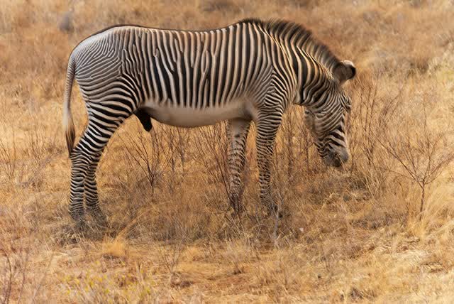
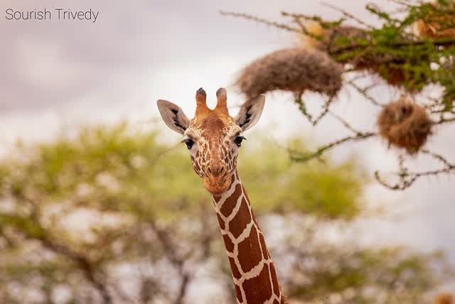
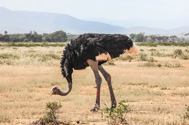
Samburu sits in northern Kenya, in drier country than the other reserves, so we saw animals there that are hard to find anywhere else in the country — reticulated giraffe, Grevy's zebra, Beisa oryx and the blue-necked Somali ostrich.
The Ewaso Nyiro river runs through it, and most of the activity gathers around it.
After the days on the mountain, sitting in a vehicle and looking at animals was a pleasant change.
Day 23August 15
Samburu, and the driver who didn't know where
Samburu National Reserve
We were given a driver who didn't speak English and was also new to the job. He didn't really know what to do with us, and got lost on the way. It annoyed us.
At the end of the day we spoke to the company we'd booked with.
Grevy's zebra, SamburuDaniel Case · CC BY-SA 4.0 · Wikimedia Commons
Day 24August 16
The guide who turned the safari around
Samburu National Reserve
The day after, they brought us a brilliant guide. Good English, knew exactly what to show us across the whole safari, and around our age. He was good fun and funny.
He turned the experience from bad to seriously enjoyable.
Samburu National Reserve
A full day in the reserve, a morning drive and an evening drive. Those are the hours when the animals move; in the middle of the day they rest in the shade, and so did we.
Somali ostrichninara · CC BY 2.0 · Wikimedia Commons
Day 26August 18
Lake Nakuru
Lake Nakuru National Park
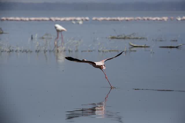
A soda lake on the floor of the Rift Valley. It's famous for its flamingos — when they're there in numbers the shore looks pink from a distance — and for more than 400 other bird species.
It's also one of the few places you see both white and black rhino, and Rothschild's giraffe.
The flamingos are one of the things that stayed with me from Kenya.
Lesser flamingos, Lake NakuruThomas Fuhrmann · CC BY-SA 4.0 · Wikimedia Commons
Day 27August 19
Lake Naivasha
Lake Naivasha
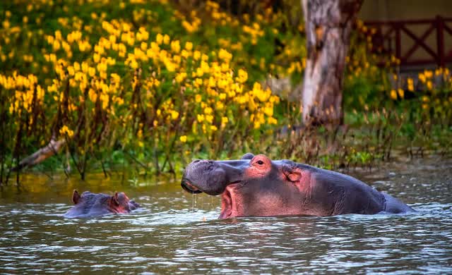
A freshwater lake, which is rare in this area. It has hippos and a lot of birds, and we went out on a short boat trip to see them up close.
Hippopotamus, Lake NaivashaRay in Manila · CC BY 2.0 · Wikimedia Commons
Day 28August 20
Hell's Gate — cycling among the animals
Lake Naivasha · Hell's Gate National Park
We spent a day touring the reserve, and cycled through it. Hell's Gate is one of only two parks in Kenya where you're allowed to walk and cycle without a ranger escort, because there are almost no large predators in it. So you pass zebra and giraffe from very close, on a bike.
We rode the trail until we reached a local village, and they took us round the area where they live.
From there we carried on to the springs. There were a lot of them. It was one of the most enjoyable days I had on the whole trip.
Uganda, and the Rwenzori Marathon
Day 29August 21
From Kenya to Uganda
21–23 August · Nairobi → Kampala → Kasese
Three days moving between Kenya and Uganda, on the way to the Rwenzori.
Day 30August 24
The Rwenzori Marathon
The Equator Marathon, 42.4 km → Kasese
I registered for the race a month in advance, before I'd even left Israel. It's an official race — the Tusker Lite Mt Rwenzori Marathon — and the event is called The Equator Marathon.
We started early in the morning. 42.4 km to Kasese.
Tomorrow the Kilembe Trail starts. Seven days to Margherita, 5,109 m.
The Rwenzori
Day 31August 25
The gumboots, and into the rainforest
Kilembe (1,450 m) → Sine Camp (2,585 m)
We weren't ready for how wet this was going to be.
We showed the guide our boots — waterproof hiking boots, good kit. He said no chance, you have to wear gumboots, because of the rain and the mud. The Rwenzori is rainforest, and one of the wettest places in Africa. At first we argued with him. Then we said fine, let's listen.
Lucky we listened.
Day 32August 26
The mud
Sine Camp (2,585 m) → Kalalama (3,147 m) → Mutinda Camp (3,588 m)
Every day you walk in mud, hopping between small rocks so you don't sink past your knee. It rains the whole time, and you slip and fall the whole time. That's why the pace is so slow.
We were amazed at how easily the guides do it.
Day 33August 27
Namusangi Valley
Mutinda Camp (3,588 m) → Bugata Camp (4,062 m)
You pass through the Namusangi Valley, and that's where the landscape starts to change. These are the alpine bogs, and in them the Giant Lobelia — a plant that comes out of the ground like a column and reaches the height of a person. It grows only in this zone, between 3,500 and 4,500 m.
It looks like a landscape from another planet, and you're walking through it in mud up to your knee.
Day 34August 28
Bamwanjarra Pass, and the shakshuka
Bugata Camp (4,062 m) → Bamwanjarra Pass (4,450 m) → Hunwick's Camp (3,974 m)
Along the way we really connected with the team and the guides. We even taught them how to make shakshuka.
Day 35August 29
Lake Kitandara and Scott Elliott's Pass
Hunwick's Camp (3,974 m) → Margherita Camp (4,485 m)
The day that brought us to the camp you leave from for the summit. We passed the Kitandara lakes and then climbed through Scott Elliott's Pass.
From here up the bogs ended and rock and ice began. Margherita Camp sits at 4,485 m, and you set out from it at midnight.
Seeing rock and ice after a week of mud was strange.
Day 36August 30
Margherita Peak
Margherita Camp (4,485 m) → Margherita Peak (5,109 m)
We got up at midnight. Snow was falling outside and the night was frozen. We had a small meal, took water and food with us, and knew this was going to be a long way to the summit.
The whole way there was fog and snow. At night it was hard to find the route — you only see a few steps ahead. Rotem and I just hoped it would work, and that we wouldn't have to turn back because of the weather.
Over time we found the route and climbed slowly. The mountain was technical, and you had to pay attention to every step.
The sun started coming up and we hoped the fog and snow would go with it. The weather didn't improve.
We reached the summit, and you can't see anything around you. A shame, because we'd been told the view from there is incredible.
We came to this summit far more prepared, physically and mentally, and it felt much simpler and more fun. We stayed up there a while and then started down, because the wind was freezing us.
Nothing to do with the summit — the whole week we walked was in rain. We walked in gumboots, and every step you could get stuck in mud up to the knee.
We did the descent with a lot of abseiling. That was fun. We were back down a little before midday.
Day 37August 31
The last day — down to Kilembe
Hunwick's Camp (3,974 m) → Oliver's Pass (4,505 m) → Kilembe (1,450 m)
We did the whole descent in two days instead of three. We'd arrived already acclimatised and physically ready from the previous mountain, so we pushed the pace the whole way along the route.
This day drops more than 3,000 m — from the alpine zone, through the bogs and bamboo, back into rainforest. The same sequence of vegetation zones you climbed up through, only reversed and all at once.
Day 38September 1
After the trek
Kasese
The day after. Seven days of rain and mud, one summit, and a lot of mud to wash off the gear.